NZ#2 - The Beauty
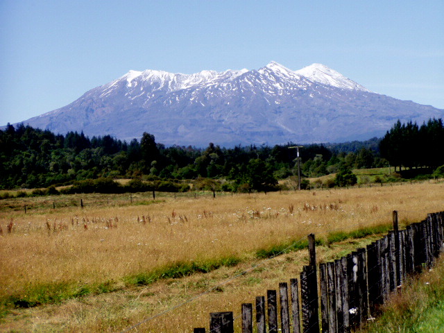
We traveled from Auckland, NI down the western side to Wellington, NI. This is where we found numerous roads closed to traffic because of the damage done by the heavy rains of February. See Photo #1 of the Tongariro National Park on NI. After crossing on the ferry, we took a counter-clockwise path around South Island.
The weather in the northern section of SI is nearly always good…the warmest and the driest of the island with the greatest percentage of sunshine. As we approached the West Coast through the Buller Gorge, we could see the low dark clouds looming ahead. I’m afraid that, although the west coast of SI is the most picturesque of all, the weather cannot be recommended. The average rainfall here is 200”. When it is not raining, the clouds seem to be ever-present. We can imagine that a sunny day on the west coast must be something to remember forever!
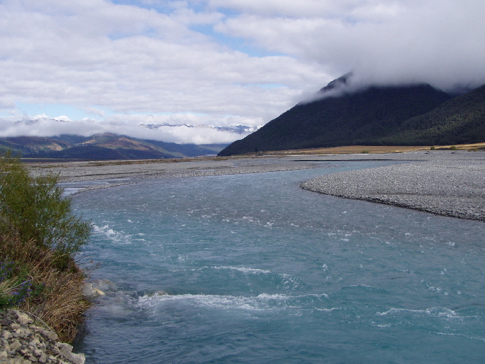
If you have ever experienced the coastal road from San Francisco on south, you have a bit of an idea of the setting for the west coast of SI. You will find a line of mountains and glaciers running generally from north to south and pushing very close to the Tasman Sea to the west. The road is twisting and turning as it clings to the steep sides of the mountains and presents marvelous views of the craggy waterline and crashing surf. Partway down the coast you come to Punakaiki and then on to the towns whose history is tied into the short gold mining days of the 1880’s and 1890’s. There are many large rivers to cross and seemingly tons and tons of pebbles pushed down from the glaciers and the mountain flows. See Photo #2 It is impossible to be away from the rivers of South Island for long. The roads follow the rivers through the valleys and over the numerous bridges. Take care! Those bridges are primarily one-way and you must heed the signs to know who has the right of way. The longest bridge along the west coast was about 400 meters and had three bays for turning off to allow an oncoming car to pass.
One of the biggest tourist draws on the West Coast are the two glaciers, Franz Josef and Fox. The weather cooperated from the standpoint of just drizzling so that we had a good look at both. The DOC has done another topnotch job at protecting the surroundings but still allowing a good site and explanation of the glaciers. As you approach the Franz Josef glacier in the car there is a sign that reads “The glacier reached this point in 1751.”
Since the face of the glacier is a remarkable distance from that point, it is hard to imagine that glaciers “always advance” as we have read. See Photo #3 of the Fox Glacier.
As we crossed the Haast Divide at the southern end of Westcoast, the sun broke out and gave us a marvelous view of Lake Wanaka. You will need to read the next message for this part of the trip, because there is a great picture to include and we have used the limit on this message!
 |  |  |